Insiders Guide to Local Beauty Spots
Discover natures hidden treasures in Bishop's Castle and Beyond
Immerse yourself in the breathtaking landscapes of this enchanting region, where secrets await at every turn. While a regular bus service from Bishop's Castle to Shrewsbury provides convenient access to destinations like the Stiperstones, Mitchells Fold, and Bromlow Callow (visit www.minsterleymotors.co.uk for more information), the Shropshire Hills Shuttle Buses (www.shropshirehillsshuttles.co.uk) offer weekend services from April 30 to October 2, allowing you to explore picturesque villages and the majestic Long Mynd and Stiperstones. Get ready to uncover the hidden gems that await you in this captivating corner of the world.
There is a regular bus service from Bishop’s Castle to Shrewsbury, except on Sundays, which gives access to the Stiperstones, Mitchells fold and Bromlow Callow – www.minsterleymotors.co.uk. The Shropshire Hills Shuttle Buses www.shropshirehillsshuttles.co.uk run at weekends from April 30 to the October 2 and can be used to access villages and the hills. They give access to the Long Mynd and Stiperstones.
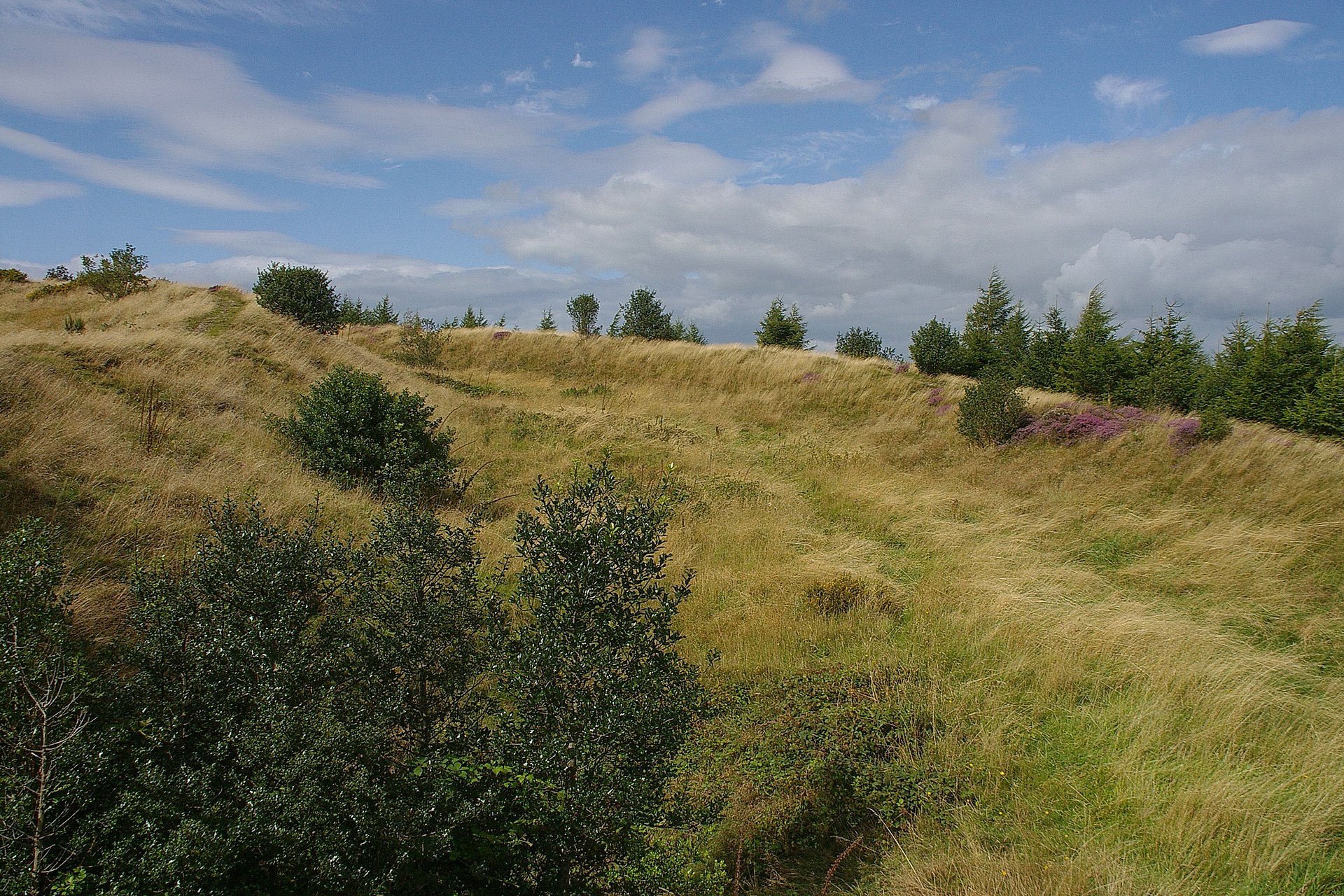
BURY DITCHES AND COLSTEY WOODS
A well preserved Iron Age hill fort at the summit of Forestry Commission woodland. There are marvellous, panoramic views over the surrounding countryside, a picnic area and car park. Shell fossils abound in the stones around the fort. Graded walks and a nature trail give visitors the opportunity to see the woodland and its wildlife.
Directions: From Bishop’s Castle take B4385 towards Craven Arms and Lydbury North. Turn off right to Brockton and follow the road through Lower Down. Carry straight on towards Clunton and at the top of a rise is a clearing on the right for car parking. Walk up the path (not the forest road) and at the top climb over the gate. On leaving turn right and follow the road to Clunton (turning right again to Clun). From Clun take the B4368 to Clunton and turn left. The carpark is about two miles on the left.

OFFA’S DYKE
The ancient ditch and dyke which once formed part of the England/Wales border runs a few miles to the West of Bishop’s Castle and Clun, it crosses the valley near Newcastle-on-Clun and this stretch contains some of the best preserved examples of the original earthwork. Many serious walkers do the whole length – a holiday in itself – but it is well worth walking short sections.
Directions: From Bishop’s Castle go along Welsh Street (left past the Town Hall) and follow the road, the Kerry Ridgeway, past Bishop’s Moat and the Dog and Duck cottage until you see sign posts for the path. Alternatively, at Bishop’s Moat take the turn for Mainstone and, in the village, turn right for Church Town.
The path crosses the lane by Mainstone Church.Walking right (north) gives superb views over the Camlad valley. Walking left (south) leads over moorland and farmed upland to the valley of the River Unk. From Clun take the B4368 towards Newcastle-on-Clun and about a mile from the village the Dyke crosses the river and the road.
THE KERRY RIDGEWAY
This 15 mile route from Bishop’s Castle to the Cider House Farm in Powys is one of the oldest in the land – you will be walking through history from the Stone Age to the drovers of recent centuries and enjoying spectacular views from this crest. After leaving the town it never dips below 1,000ft. and 70 miles can be seen on clear days. The route is gently undulating and can be legally used by horse riders and motor bikers as well as walkers. It is crossed by ancient ditches and the way marked by Bronze Age burial sites, stone circles and earthworks of the Iron and Dark Ages.
Directions: From Bishop’s Castle go left at the Town Hall (Welsh Street) or right at the Six Bells Inn (Kerry Lane) to walk up onto the Ridgeway. At this stage the Ridgeway is a metalled land and follow it until Pantglas when it veers left to cross the Kerry Hills.
")
THE CANTLIN STONE & THE BOTFIELD CROSS
Off the Kerry Ridgeway, in the heart of the Clun Forest (OS 20.2/86.9) marks the spot where a local pedlar,William Cantlin, was robbed and murdered while walking between farms in 1691. The body was taken by the parishioners of Bettws-y-Crwyn and buried in their churchyard and later this act of kindness was used in the argument over the boundary of the parish. Later, in 1858, a local landowner and M.P. named Botfield erected a limestone cross at the spot.
Directions: From Bishop’s Castle centre turn left past the Town Hall and follow the road up on to the Kerry Ridgeway. Continue on the ridgeway until the junction about a mile past where the Offa’s Dyke crosses. Bear left and follow this small road into the woods. Take a left turn towards Crossways and Newcastle and the Cantlin Stone is a short distance away.
Or go to Newcastle-on-Clun, turn left and follow the B4368 for about three miles to the Anchor Inn, which is open every evening from 7.00pm providing a warm welcome and well kept beer!, then turn right up the Sarn road for about half a mile until you reach the crossroads then turn right into the forest, follow the road for about half a mile. The Cantlin Stone is on the right.
LONG MYND
The dramatic hogs back hill which lies between Bishop’s Castle and Church Stretton, its steep escarpment facing west towards the former. It is the most southerly moor of its type in England, and has completely breathtaking views. The Portway, a pre-historic trackway, runs along its ridge and many public footpaths give access.
Directions: From Bishop’s Castle turn left for Wentnor off the A489 (Craven Arms road) and before the village turn right to Asterton. Turn right at the junction and immediately left up the steep slope. At the top is the Midland Gliding Club and gliders and hang gliders can be seen when the weather is suitable. Alternatively, past the Green Caravan Park at Wentnor and follow the road to Bridges, turn right over the Mynd to Church Stretton.
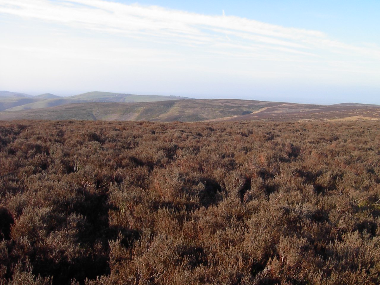
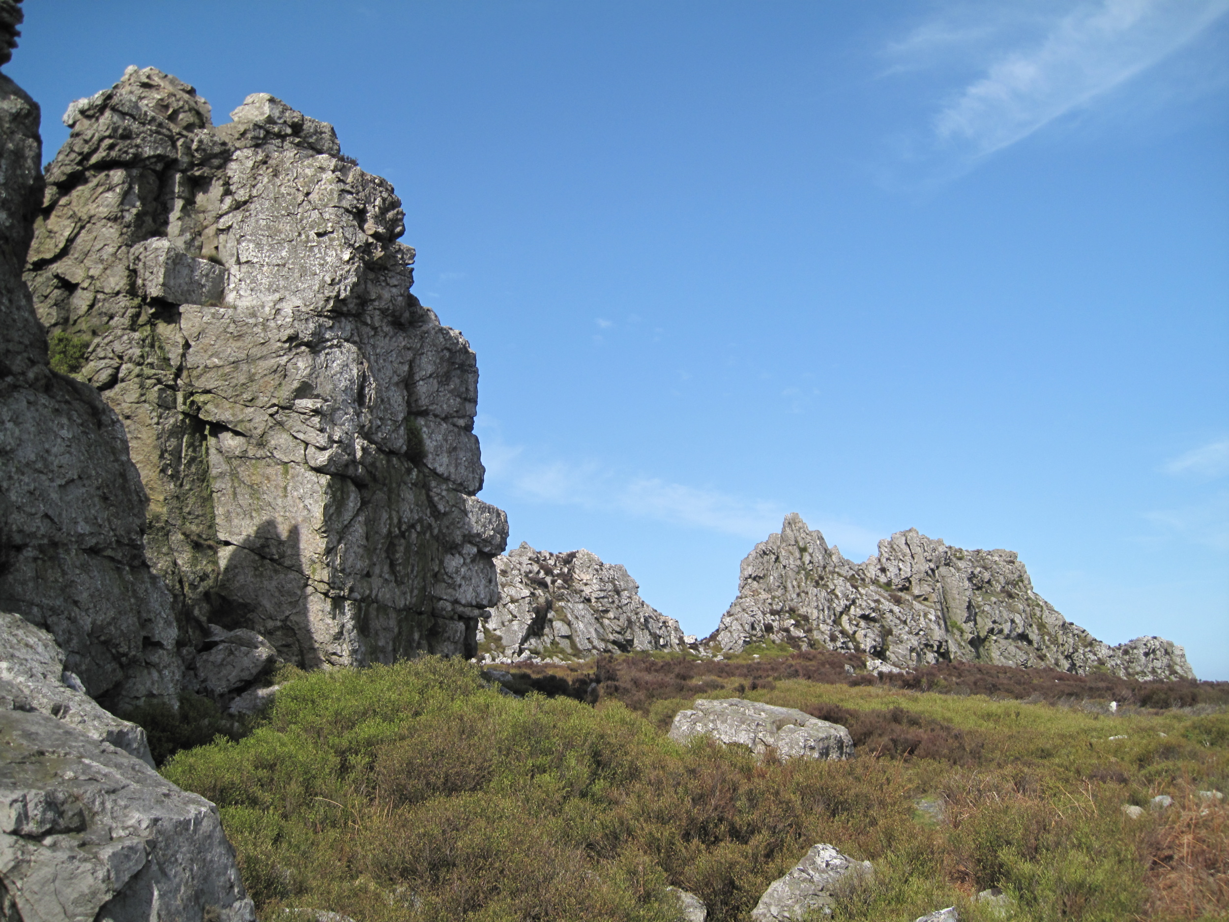
STIPERSTONES
This three mile long outcrop of quartzite, a National Nature Reserve, gives a harsh landscape different to other Shropshire hills and there are many legends – the Devil is reputed to hold court here, hence the rock outcrop called the Devil’s Chair. Its mineral wealth has been exploited since Roman times and discarded shafts and abandoned engine houses can still be seen today (see Snailbeach Lead Mine in “What to do” section.).
The views are breath taking and there are many public footpaths. There are refreshments available at The Bog Centre (See places to visit).
Directions: From Bishop’s Castle the most scenic drive is to go a short distance on the A488 towards Shrewsbury and turn right towards More. Turn left and immediately right at the junction with the A489 and continue along past the Inn on the Green. Turn left towards Cold Hill and left at the junction and right at the next junction. The car park is on the left at grid ref 97.8N, 37.OW on OS map. Walk up the rocky path to the outcrops (best views). Go back to Shelve and the main A488.
MITCHELLS FOLD
Ancient stone circle with good views towards the Welsh hills. The Stapeley Hills Historic Trails, 50p, also takes in the Holy Well and Hoarstone Stone Circle.
Directions: From Bishop’s Castle take A488 towards Shrewsbury for about 11 miles and turn left at the sign post just past the red telephone box on the right hand side. There is a ruined mine shaft at the junction. Follow the English Heritage signs. Park in the car park and walk up through the gate.

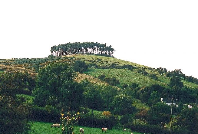
BROMLOW CALLOW
This hill with its top-knot of trees is a landmark on the Bishop’s Castle to Shrewsbury road (A 488) and has strong associations with the Mary Webb heroine Hazel Woodhouse who lived at The Callow. There are many excellent walks in the area with renewed stiles, gates and sign posting and some of it enjoys “right to roam”. Walkers can use the Callow Inn car park and it is easy walking from Mitchells Fold and the Stapeley Hills.
Directions: From Bishop’s Castle take the A 488 towards Shrewsbury for about 14 miles and turn left at the Shelve crossroads.